I spent a few days in the Yorkshire Dales in the UK, which is a typical karst landscape. Karst is the way in which limestone landscapes are formed, and it revolves around the fact that limestone rock dissolves in acid water. One of the basic principles of a karst landscape is that rivers flow in at the top of the limestone massif from outside, the water dissolves the limestone and disappears underground, and the rivers reappear in springs at the base of the mountains. This simplified diagram clarifies the processes:
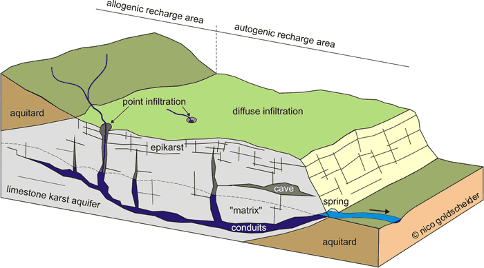
karst hydrology diagram from: Goldscheider and Drew (2007)
I stayed in Malham village, on the southern slope of the Yorkshire limestone massif, and saw the process in action. A large lake – Malham Tarn – has been formed on the top of the limestone plateau on a layer of impervious rocks or clay. The outflow of the lake flows for a few hundred metres on the surface until the water disappears in a sink, through cracks in the ground. I visited after a period of heavy rain, and the stream of water flowing into the limestone sink was quite substantial.
The sinking water of Malham Tarn
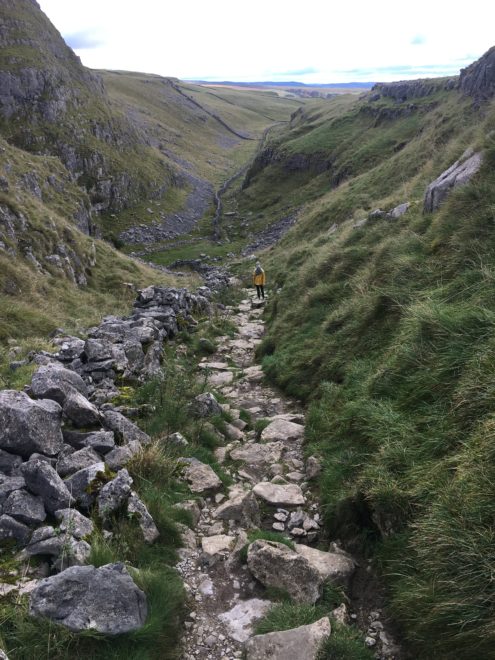
In the distant geological past, the water may have flowed down a valley to the top of Malham Cove. This valley is now dry, although water was flowing for a day in 2015 after an extremely heavy, long downpour.
My wife and I walked along the valley, which has a serene beauty in its dry simplicity. The landscape is made of grey limestone cliffs, scree slopes without any vegetation and dry-stone walls. The fields higher up and in the bottom of the valley have little grass, which is munched by a few sheep that seem to roam around without any control.
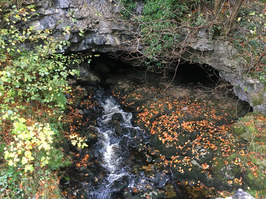
The water that flows from the Malham Tarn sinkhole seeps through the limestone, and reappears at Malham Cove at the base of the limestone. Malham Cove is an impressive limestone cliff, that looks like a massive amphitheater. Apparently, the water flows from a submerged cave that has been explored by divers, but as a tourist all you see is water bubbling up at the base of the cliff. Dye tracing has proven that this is the water from Malham Tarn, and it forms the spring of the River Aire.
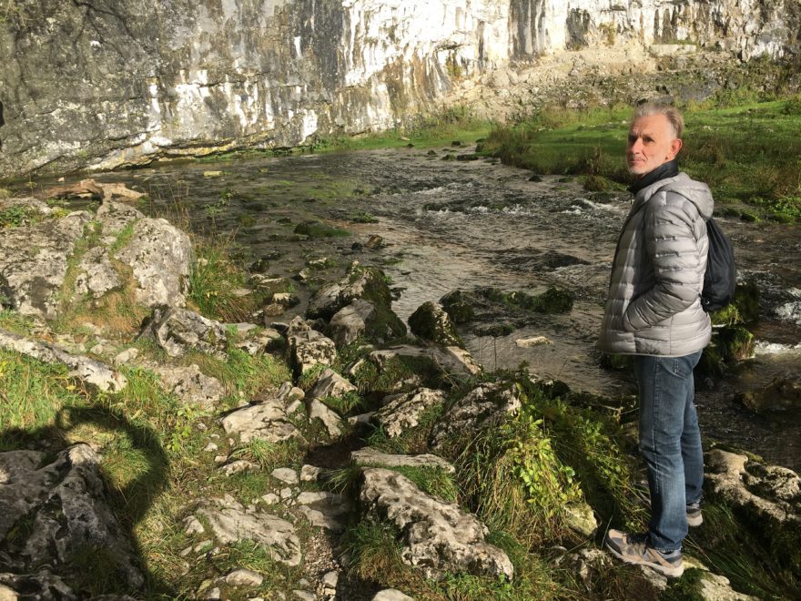
The spring at Malham Cove
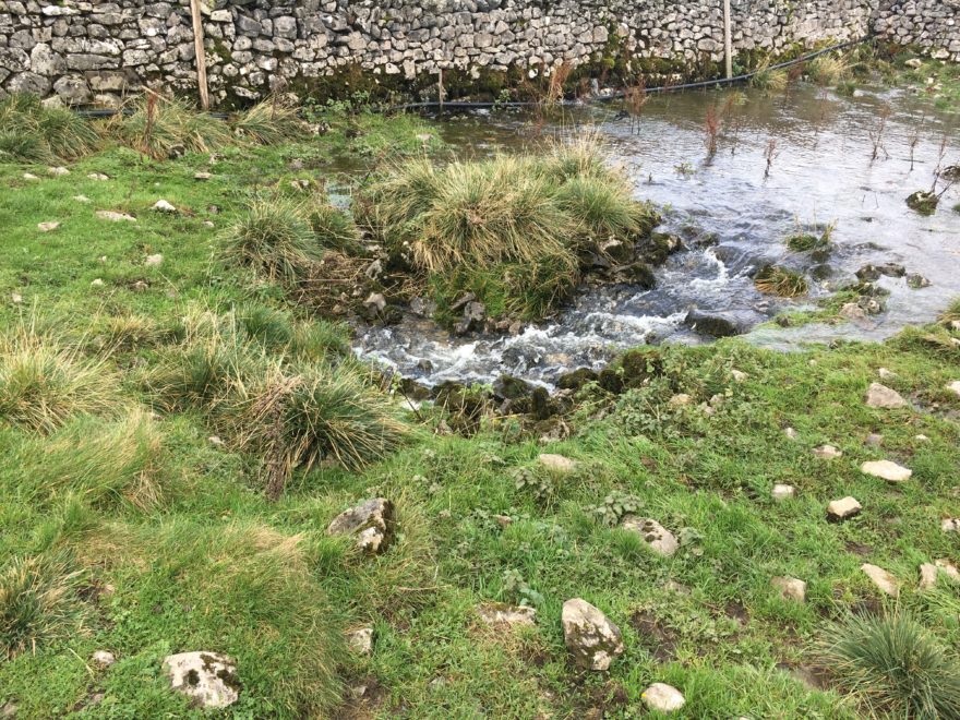
Several hundred metres further south is another spring, which is a hollow in the field, and dye tracing has proven that this is also water from the Malham Tarn sink. Dr Tony Waltham has written extensively about the hydrology and the discussions about the possible origins of Malham Cove, and his description is worth reading.
When the limestone solution process that has created this underground water transfer continues for hundreds of thousands of years, the cracks through which the water flows get bigger and bigger, and eventually they form caves that can be explored. This is what can be seen further west at Ingleborough Mountain.
We went to the village of Clapham the following day, and climbed the slopes of this limestone mountain in the mist, looking for Gaping Gill cave. We found the cave, which is a large “hole-in-the-ground”. The cave is actually a nearly 100-metre-deep shaft, that takes the water of the Fell Beck stream flowing from the higher slopes of Ingleborough Mountain.
The water from Fell Beck flows through the Gaping Gill cave passages and can be followed to a static underground lake at the bottom of the cave system, which is called a sump. Divers have explored further, and managed to make the connection with Ingleborough Cave at the base of the mountain, where the water reappears as the spring of the Clapham Beck.
The underground hydrology is similar to the situation in Malham, but here the water can be followed all the way though accessible cave passages.
Clapham Beck river flowing out of Ingleborough Cave
It was a real pleasure to see these two stages of geomorphology in action, and be reminded of my former speleology and karst research days.
0 comments
Write a comment